McPhee Overlook: from House Creek Campground to Dolores
About the Trail
Newly opened in 2017, the McPhee Overlook trail is the hidden jewel in the Town of Dolores. This trail cuts along the cliff face overlooking McPhee Reservoir, the second largest body of water in the state. Hikers and bikers revel in the challenge of this route, with switchbacks on the Dolores End and throughout the trail.
Tips – Unless you want to do 13.6 miles as a round trip, I recommend doing a 3 mile turnaround on either side of the trail, or plan ahead and have a vehicle waiting on the other side.
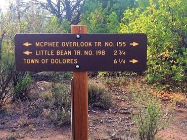
Starting Out – I was dropped off at the House Creek Campground and made my way back to Dolores. To get there from the Town of Dolores, turn onto 11th street and head north (this road is also known as Road 31, or the Dolores Norwood Road). Basecamp Convenience Store and GST Liquors is on the corner. Drive for about 8 miles and turn left onto the House Creek Entrance Road. Just before you reach the water, you'll see signs to turn left into the House Creek Campground. Parking for the trail head is immediately on your left. Get on the trail and soon you'll see signs turning you right towards the Town of Dolores. This sign says 6.25 miles, but my GPS mapped me at 6.8 miles.
Along the trail – I could almost immediately see the water's edge, and skirted the campground towards the cliff's, heading uphill for the next 3 miles. The path was shaded with Juniper trees, pine trees, and a variety of shrubs, cactus, and drought-resistant vegetation. Spring will give you some pretty flowers to admire. You can see the marina on the other side of the lake, and you'll come across plenty of selfie opportunities. Around 3 miles in, you'll hit the switchbacks taking you down closer to the water, but alas, you will never get remotely close enough to actually get in the water. 4.5 miles in you'll come to a clearing and head away from the water going into a meandering uphill and downhill climb, eventually heading back to the cliff edge before finally making your way down into Dolores. One more set of switchbacks leads you to the bottom of the Dolores trail head, popping you out at Central Avenue near the cemetery and the Dolores River Trail. I had left my car parked there, waiting for my arrival.
Other Info – I've been on this trail starting from either end and have seen horseback riders, bikers, plenty of pets, and sometimes no one at all. I've come across rabbits and deer, and have found evidence of coyotes in the area, although never actually seeing any. This is a seasonal trail, closing from December 1st thru April 15th to protect the winter range of many animals. This trail has been incorporated into the Escalante Days Mountain Bike race that happens on the 2nd Saturday of August every year. It's still a relatively unknown path, with no signage from the main roads getting you to either end of the trail. So, act like a local, find your way there, and experience a fantastic trek along McPhee.
Stats
Length: 6.8 miles one way from House Creek Campground to Dolores
Elevation: House Creek: 6996 ft
Elevation: Dolores: 6931 ft
Elevation Gain: 656 feet
Completion time: 2-3 hours hiking
Difficulty: Moderate
Closed: Dec 1 - Apr 15
Porta Potty: Yes - Dolores
Bathroom: Yes - House Creek
Links: